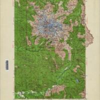
Mt. Rainier (1924)<br>Washington 1:125,000 topographic quadrangles
Title
Mt. Rainier (1924)<br>Washington 1:125,000 topographic quadrangles
Subject
Washington (State) -- Maps, Topographic
Description
1 map : col. ; 45 x 31 cm. or smaller<br>Relief shown by contours and spot heights<br>Title supplied by cataloger<br>Set includes various editions<br>Surveyed in 1924"<br>"Contour interval 100 feet. Datum is mean sea level."<br>"Park area reduced from map of Mt. Rainier National Park."<br>Includes green shading indicating wooded areas<br>Highway information in red overlayed in the 1956 and 1965 reprints.<br>Scale 1:125,000 Polyconic proj. (W 122°00--W 121°30/N 47°00--N 46°30)
Creator
U.S. Geological Survey<br>McKinley, C.P.<br>Chenoweth, W.R.<br>U.S. Coast and Geodedic Survey
Source
University of Washington Libraries Map Collection
Publisher
Washington, D.C. : The Survey
Date
1965
Contributor
University of Washington Libraries Map Collection
Rights
This image may be freely downloaded and used. Please give credit to the University of Washington Libraries.
Relation
From the series: Washington 1:125,000 topographic quadrangles
Format
image/jpeg
Language
English
Type
Maps<br>Topographic Maps
Identifier
topo42<br>WA 30: Mt. Rainier 1924
Coverage
United States -- Washington (State) -- Lewis County
United States -- Washington (State) -- Pierce County
United States -- Washington (State) -- Pierce County
Collection
Citation
U.S. Geological Survey<br>McKinley, C.P.<br>Chenoweth, W.R.<br>U.S. Coast and Geodedic Survey, “Mt. Rainier (1924)<br>Washington 1:125,000 topographic quadrangles,” Digital Exhibits, accessed November 25, 2024, http://752800.40daj.group/items/show/1836.
