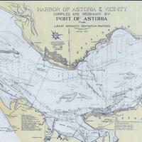
Harbor of Astoria & Vicinity. (1927)
Title
Harbor of Astoria & Vicinity. (1927)
Subject
Columbia River -- Mouth -- Maps
Description
1 map: color, 35 x 92 cm. <br>Soundings are in feet and show the depth at Mean Lower Low Water. Various types of hachures show various depth contours: thirty foot, twenty-four foot, eighteen foot, twelve foot, and low water lines. <br>Scale: approximately 1 cm. = 1000 ft.
Creator
Port of Astoria
Source
Manuscripts, Archives, and Special Collections, WSU Libraries
Publisher
[Astoria, Or.: Port of Astoria]
Date
1927
Contributor
Manuscripts, Archives, and Special Collections
Rights
Contact Manuscripts, Archives, and Special Collections, for copyright information 509 335-6691
Format
image/jpeg
Language
English
Type
Maps
Identifier
wsu 589<br> Historical Maps Collection 2.24
Coverage
United States -- Oregon -- Clatsop County -- Astoria
Washington (State) -- Pacific County
Columbia River
Washington (State) -- Pacific County
Columbia River
Collection
Citation
Port of Astoria, “Harbor of Astoria & Vicinity. (1927),” Digital Exhibits, accessed February 20, 2025, http://752800.40daj.group/items/show/2097.
