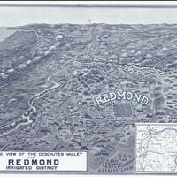
Birdseye view of the Deschutes Valley and Redmond irrigated district. (1910)
Title
Birdseye view of the Deschutes Valley and Redmond irrigated district. (1910)
Subject
Redmond (Or.) -- Description and travel -- Aerial -- Maps. <br>Oregon -- Pictorial works.
Description
1 map: 17 x 23 cm.<br>Inset: [North-Central Oregon] <br>Redmond, Oregon was platted in 1905, near both a planned canal and a planned railroad. The town was named after two local settlers.
Source
Manuscripts, Archives, and Special Collections, WSU Libraries
Publisher
s.n.: s.l.
Date
1910
Contributor
Manuscripts, Archives, and Special Collections
Rights
Contact Manuscripts, Archives, and Special Collections, for copyright information 509 335-6691
Relation
Is found in Redmond Now
Format
image/jpeg
Language
English
Type
Maps<br>Bird's-eye views
Identifier
wsu 538<br>Vertical File 1838
Coverage
United States -- Oregon - Deschutes County - Redmond
United States -- Oregon
United States -- Oregon
Collection
Citation
“Birdseye view of the Deschutes Valley and Redmond irrigated district. (1910),” Digital Exhibits, accessed February 12, 2025, http://752800.40daj.group/items/show/2032.
