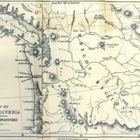
Map of the Columbia to illustrate Ross's adventures
Title
Map of the Columbia to illustrate Ross's adventures
Subject
Northwest, Pacific -- Maps. <br>Oregon -- History -- To 1859. <br>Pacific Fur Company.
Description
1 map; 20 x 25 cm. <br>The author of this map (and the book it comes in) was a trader in the employ of John Jacob Astor's Pacific Fur Company, and took part in Astor's first expedition to the northwest to establish the profitability of the fur trade there. The expedition departed by sea from New York City in late 1810, and arrived at the mouth of the Columbia River in March of 1811, where it built Fort Astoria. Over the years he spent in the northwest, he traveled the length and breadth of the future state of Washington (with the notable exception of the areas west of the Cascade Mountains), and also assisted in the building of Fort Okanogan and Fort Nez Perce. He remained in the northwest until 1823, at which point he traveled to what would later become Montana, where he would remain until his death in 1856.
Creator
Ross, Alexander, 1783-1856.
Source
Manuscripts, Archives, and Special Collections, WSU Libraries
Publisher
London : Smith, Elder and Co., 1849.
Date
1849
Contributor
Manuscripts, Archives, and Special Collections
Rights
Contact Manuscripts, Archives, and Special Collections, for copyright information 509 335-6691
Relation
Is part of Adventures of the first settlers on the Oregon or Columbia River
Format
image/jpeg
Language
English
Type
Maps
Identifier
wsu 478<br>979.5 R733aS
Coverage
United States -- Oregon Territory
Collection
Citation
Ross, Alexander, 1783-1856., “Map of the Columbia to illustrate Ross's adventures,” Digital Exhibits, accessed November 25, 2024, http://752800.40daj.group/items/show/1958.
