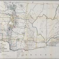
Map of public surveys in the Territory of Washington to accompany report of Surveyor General, (1865)
Title
Map of public surveys in the Territory of Washington to accompany report of Surveyor General, (1865)
Subject
Washington (State) -- Maps<br>Washington Territory<br>Indian reservations -- Washington (State) -- Maps<br>Surveys -- Washington Territory
Description
1 map : col., 59 x 78 cm <br>Includes rail roads, Indian Reservations, surveys (those executed, proposed, and under contract), roads, projected roads, and mineral deposits.
Creator
United States. General Land Office.Dept.
Source
Manuscripts, Archives, and Special Collections, WSU Libraries
Publisher
Olympia : Surveyor General's Office
Date
1865
Contributor
Manuscripts, Archives, and Special Collections
Rights
Contact Manuscripts, Archives, and Special Collections, for copyright information 509 335-6691
Format
image/jpeg
Language
English
Type
Maps
Identifier
WSU 294<br>G4280 1865 .U56
Coverage
United States--Washington (State)
Collection
Citation
United States. General Land Office.Dept., “Map of public surveys in the Territory of Washington to accompany report of Surveyor General, (1865),” Digital Exhibits, accessed February 21, 2025, http://752800.40daj.group/items/show/1866.
