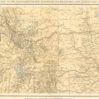
Map of the Northern Pacific Railroad, its branches and allied lines, (1883)
Title
Map of the Northern Pacific Railroad, its branches and allied lines, (1883)
Subject
Railroads -- West (U.S.) -- Maps<br>Railroad travel -- Northwest, Pacific -- Maps<br>Northern Pacific Railroad<br>Oregon Railway and Navigation Company<br>Washington Territory
Description
1 map: col., 34 x 73 cm. Scale 1"=80 miles. <br>Map shows Northern Pacific Main Line, Northern Pacific Branches, Oregon and Transcontinental Lines, Oregon Railway and Navigation Company Lines, and uncompleted roads. <br>After the initial burst of construction by the Northern Pacific in 1870-1871 a faltering economy began to affect the Railroad, and by 1872 financial disaster had occurred and construction was halted. In 1873, the company failed in a financial panic. <br>Between 1873 and 1875, the company was reorganized and refinanced, and earnings from the transportation of coal along existing routes allowed the company to keep its head above water and even turn a slight profit. In 1879, new financing was arranged, and work began along almost the entire route. The Northern Pacific's transcontinental route was finally finished in 1883, nineteen years after the Congressional act which originally created it. <br>The two other rail companies shown here were both partners with the Northern Pacific at this time. The Oregon Railway and Navigation had previously constructed its own tracks along the Columbia, and in 1880 the Northern Pacific achieved a temporary arrangement with them to use their tracks while constructing their own. Seeing his railroad's demise in a competing Northern Pacific route, the President of the OR&N, Henry Villard, conducted a successful takeover of the Northern Pacific. The Oregon and Transcontinental was created by Villard to facilitate the cooperative operation of the two railways.
Creator
Northern Pacific Railroad
Source
Manuscripts, Archives, and Special Collections, WSU Libraries
Publisher
New York : Julius Bien & Co. lith
Date
1883
Contributor
Manuscripts, Archives, and Special Collections
Rights
Contact Manuscripts, Archives, and Special Collections, for copyright information 509 335-6691
Relation
Is part of Report of the president to the stockholders at their annual meeting / Northern Pacific Railroad.
Format
image/jpeg
Language
English
Type
Maps
Identifier
WSU 189<br>HE2791 .N853x 1883
Coverage
United States--Washington (State)
United States--Oregon
United States--California
United States--Nevada
United States--Wyoming
United States--Nebraska
United States--Utah
United States--Missouri
United States--Illinois
United States--Wisconsin
United States--Oregon
United States--California
United States--Nevada
United States--Wyoming
United States--Nebraska
United States--Utah
United States--Missouri
United States--Illinois
United States--Wisconsin
Collection
Citation
Northern Pacific Railroad, “Map of the Northern Pacific Railroad, its branches and allied lines, (1883),” Digital Exhibits, accessed November 25, 2024, http://752800.40daj.group/items/show/1729.
