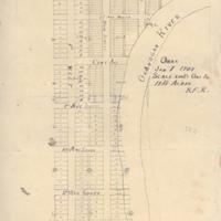
Omak [verso], Jan 1 1907
Title
Omak [verso], Jan 1 1907
Subject
Omak (Wash.)--Maps<br>Okanogan County--Maps<br>Okanogan River--Maps, Manuscript<br>Ross, Ben F.
Description
1 ms. map ; 53 x 38 cm. Manuscript town plat for the city of Omak. Scale 200 feet = 1 inch. See another version of the map on recto: http://kaga.wsulibs.wsu.edu/zoom/zoom.php?map=wsu154 <br>In 1901, Mr. Ben F. Ross, an employee of the Great Northern Railroad, settled with his family in the area that soon became Omak, Washington. By 1906, Ross had helped organize the Omak School District--the first district in the area east of the Cascade Mountains. Taking twenty acres of his own farm, Ross platted twenty-five foot town lots. This map is most likely drafted by his hand--note the initials "B.F.R." in the title. When the town incorporated in 1907, it was thanks to the boosterism of Ross. The town lay on the banks of the Okanogan River, six miles north of Okanogan and thirty miles from the Columbia River confluence. That same year, the U.S. Reclamation Service was working on the Conconully Dam Irrigation Project, which would bring water from the Salmon River near the town of Conconully, and irrigate some 10,000 acres in the Omak and Okanogan region.
Source
Manuscripts, Archives, and Special Collections, WSU Libraries
Date
1907
Contributor
Manuscripts, Archives, and Special Collections
Rights
Contact Manuscripts, Archives, and Special Collections, for copyright information 509 335-6691
Format
image/jpeg
Language
English
Type
Maps<br>Town plats
Identifier
WSU 153
Coverage
United States--Washington (State)--Okanogan County--Omak
Collection
Citation
“Omak [verso], Jan 1 1907,” Digital Exhibits, accessed February 22, 2025, http://752800.40daj.group/items/show/1691.
