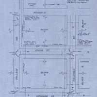
Map of Proposed Monument at College Park, Pullman, Wash., (November, 1932)
Title
Map of Proposed Monument at College Park, Pullman, Wash., (November, 1932)
Subject
Pullman (Wash.)--Maps
Description
1 map: blueprint, 29 x 23 cm. <br>The area labeled Block 7 eventually became the site of the Owen Science and Engineering Library (built 1977) and Cleveland Hall (1963), while Block 8 eventually became a parking lot. <br>This map was presumably laid out for the construction of most of the roads and lots identified on it. The term 'monument' refers to the number markers laid into the intersections.
Creator
Welch, F. H.
Source
Manuscripts, Archives, and Special Collections, WSU Libraries
Publisher
Pullman (Wash.) : City Engineer.
Date
1932
Contributor
Manuscripts, Archives, and Special Collections
Rights
Contact Manuscripts, Archives, and Special Collections, for copyright information 509 335-6691
Format
image/jpeg
Language
English
Type
Maps
Identifier
WSU 125
Coverage
United States--Washington (State)--Whitman County--Washington State University
Collection
Citation
Welch, F. H., “Map of Proposed Monument at College Park, Pullman, Wash., (November, 1932),” Digital Exhibits, accessed November 23, 2024, http://752800.40daj.group/items/show/1675.
