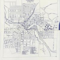
Map of campus, State College of Washington, Pullman, Wash. (1913)
Title
Map of campus, State College of Washington, Pullman, Wash. (1913)
Subject
Washington State University--Maps<br>Pullman (Wash.)--Maps
Description
1 map; 36 x 31 cm. Scale 400'=1" TWP 14& 15 N. R. 45 E. Map contains key to buildings, halls, and churches. <br>The town of Pullman was not more than fifteen years old when it won the honor of establishing the land grant college for Washington State in 1892. While the school began atop College Hill with no more than five buildings in its first few years, by 1913 it held a respectable number of classroom buildings, dormitories, recreation and sports fields, and even greek houses. In 1913, builders completed construction on the President's Mansion, and was in the middle of building both Wilson Hall (for agriculture classes and labs) and the Mechanic Arts Building.
Creator
Washington State University
Source
Manuscripts, Archives, and Special Collections, WSU Libraries
Publisher
Pullman (Wash.) : Washington State University
Date
1913
Contributor
Manuscripts, Archives, and Special Collections
Rights
Contact Manuscripts, Archives, and Special Collections, for copyright information 509 335-6691
Format
image/jpeg
Language
English
Type
Maps
Identifier
WSU 116
Coverage
United States--Washington (State)--Whitman County--Washington State University
Collection
Citation
Washington State University, “Map of campus, State College of Washington, Pullman, Wash. (1913),” Digital Exhibits, accessed November 26, 2024, http://752800.40daj.group/items/show/1664.
