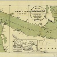
Map of the Strait of Juan de Fuca showing location of wrecks (1895)
Title
Map of the Strait of Juan de Fuca showing location of wrecks (1895)
Subject
Shipwrecks -- Juan de Fuca, Strait of (B.C. and Wash.) -- Maps<br>Nautical charts -- Washington (State) -- Clallam Bay
Description
1 map : col. ; 24 x 55 cm.<br>Relief shown by hachures and spot heights. Depths shown by soundings and isolines<br>Includes inset of Clallam Bay<br>"H. Ex. 226 53 3."<br>Color map with symbols and numbers indicating the location of shipwrecks. Numbers refer to the list of wrecks and disasters on pages 7-9 of House Ex. Doc. 226. Includes lighthouses, rocks, islands, coastal features, cities and railroads<br>Indexed in: CIS US serial set index, pt. 14, 3323 (53-3) H.exdoc. 226, map 1<br>Scale ca. 1:400,000
Creator
United States. Army. Corps of Engineers. Engineer Office<br>Downing, Alfred<br>Symons, T. W. (Thomas William), 1849-1920
Source
University of Washington Libraries Government Publications Section
Publisher
Washington : G.P.O.
Date
1895
Contributor
University of Washington Libraries Map Collection
Rights
This image may be freely downloaded and used. Please give credit to the University of Washington Libraries.
Relation
Removed from: Preliminary examination of Clallam Bay, Washington : Letter from the Secretary of War, transmitting, with letter of the Chief of Engineers, report of a preliminary examination of Clallam Bay, Washington. Washington : G.P.O., 1895. (Ex. Doc. / 53d Congress, 3d Session, House ; no. 226)<br>Removed from: Executive documents of the House of Representatives for the third session of the fifty-third Congress, 1894-95
Format
image/jpeg
Language
English
Type
Maps
Identifier
uwm86<br>Y 1.1/2: Serial 3323 map 1
Coverage
Northwest Coast of North America -- Strait of Juan de Fuca
Washington (State) -- Clallam County -- Clallam Bay
Washington (State) -- Clallam County -- Clallam Bay
Collection
Citation
United States. Army. Corps of Engineers. Engineer Office<br>Downing, Alfred<br>Symons, T. W. (Thomas William), 1849-1920, “Map of the Strait of Juan de Fuca showing location of wrecks (1895),” Digital Exhibits, accessed November 26, 2024, http://752800.40daj.group/items/show/1626.
