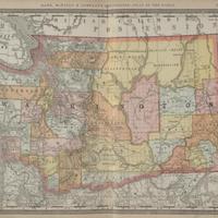
Washington Ter. = Washington Territory, (1888)
Title
Washington Ter. = Washington Territory, (1888)
Subject
Washington (State) -- Maps.<br>Railroads -- Washington (State) -- Maps.
Description
1 map : col. ; 33 x 50 cm.<br>Political map showing counties, cities and railroads.<br>Relief shown by hachures.<br>Scale ca. 1:600,000.
Creator
Rand McNally and Company.
Source
University of Washington Libraries Map Collection
Publisher
Chicago, Ill. : Rand McNally & Co.
Date
1888-1889
Contributor
University of Washington Libraries Map Collection
Rights
This image may be freely downloaded and used. Please give credit to the University of Washington Libraries.
Relation
In Rand, McNally & Co.'s new indexed atlas of the world containing large scale maps of every country and civil division upon the face of the globe, together with historical, statistical and descriptive matter relative to each. [p. 718-719]
Format
image/jpeg
Language
English
Type
Maps
Identifier
uwm65<br>G1019.R35 1888 map 1
Coverage
Washington (State)
Collection
Citation
Rand McNally and Company., “Washington Ter. = Washington Territory, (1888),” Digital Exhibits, accessed March 12, 2025, http://752800.40daj.group/items/show/1495.
